
Summerlin South ZIP Code Directory Coverage
The evidence captured for a Summerlin South ZIP code directory is deliberately narrow. County parcel samples directly verify 89135 for parcels identified as CC Summerlin South. An official City of Las Vegas ZIP-area map also labels 89134, 89138, and 89144 near the broader Summerlin area, but that map does not prove those labels fall within the Summerlin South town, planning, or CDP boundary. Check the actual parcel and a USPS result before assigning any address to the directory.
| ZIP or postal label | Area evidence | Post office result | Summerlin South directory note |
|---|---|---|---|
| 89135 | Sampled OpenWeb and Assessor records show CC Summerlin South parcels using this ZIP | Not captured in the unattended USPS result | Verified for sampled parcels; confirm each address with USPS and parcel GIS |
| 89138 | Label appears near Summerlin on the City ZIP map | Not captured | Do not treat as Summerlin South-wide without a parcel-level result |
| 89144 | Label appears on the City map and in Summerlin-branded Las Vegas context | Not captured | Nearby comparison only until a parcel confirms the legal jurisdiction |
| 89134 | City-map label and a nearby OpenWeb context | Not captured | A sampled Las Vegas parcel was not in CC Summerlin South |
| Las Vegas postal city | Parcel samples can use Las Vegas in mailing fields | Address-specific result required | Postal city does not decide incorporated-city or town jurisdiction |
The County’s current Summerlin South description uses a 6,129-acre, 10-square-mile town footprint. Older county material and the broader master plan use different area figures for different planning scopes. A ZIP code directory should name the boundary source it is using instead of treating every Summerlin-branded address as one geography.
Verify 89135 in Summerlin South Records
89135 is the directly supported Summerlin South ZIP code in the captured record set. A county OpenWeb sample shows the jurisdiction as CC Summerlin South-89135, while the site address and other parcel data identify the property record. The Assessor is useful because it keeps separate fields for a location address, City or Unincorporated Town, owner, and mailing address. Those fields often answer different questions.
For a ZIP code directory search, read the parcel’s legal City or Town field alongside the situs. A mailing field may show Las Vegas and 89135 even though the parcel belongs to unincorporated Clark County. That distinction directs the reader to county, not municipal, land-record channels. It also prevents a postal label from being misread as a legal boundary.
The Clark County Assessor parcel-card example supplies the record context used for this Summerlin South ZIP code finding.
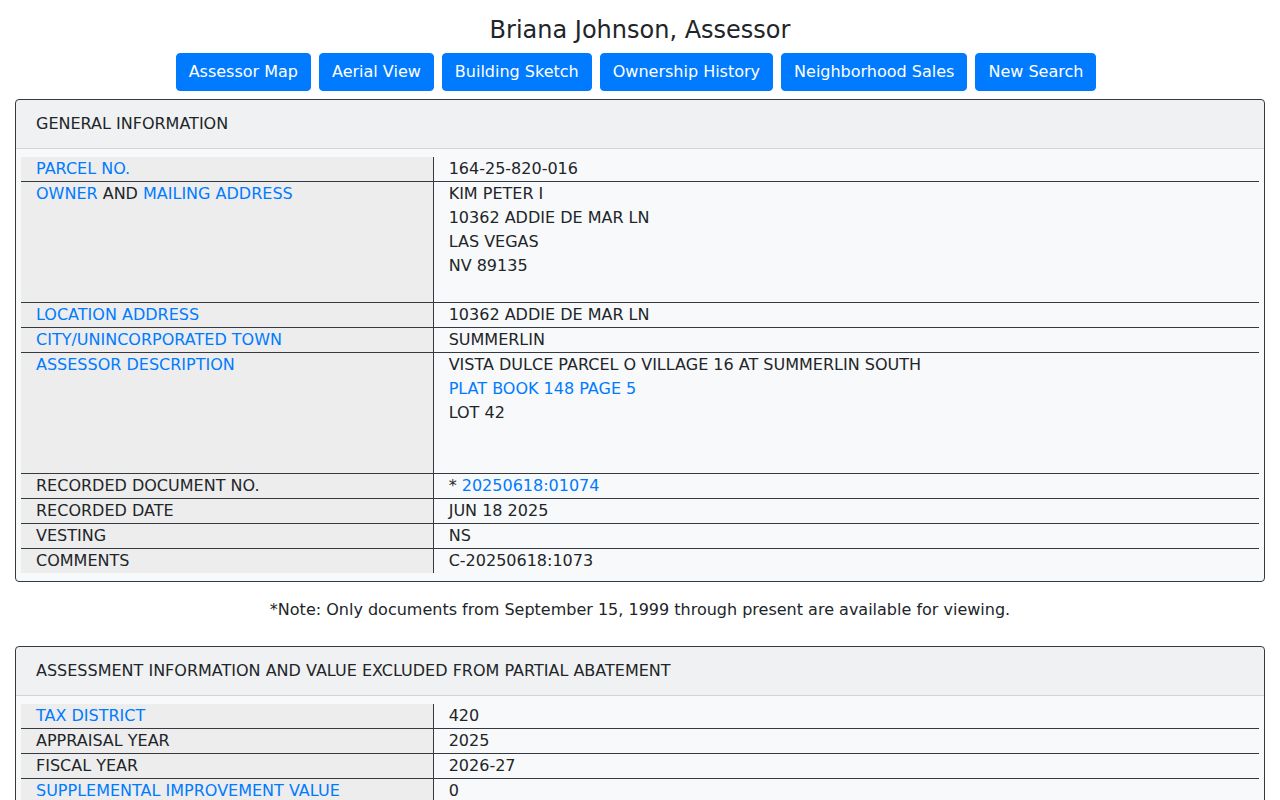
The parcel card illustrates why a ZIP label should be read with the situs, jurisdiction, and mailing fields rather than as a standalone resident result.
Check USPS Before a ZIP Code Search
Use the USPS ZIP Code Lookup with the complete address before searching county records. USPS is the authoritative address-to-ZIP check. The captured unattended session did not return a completed Summerlin South address result, so it does not support a claim about a specific post office, ZIP+4, or delivery boundary. The live result should be saved with the address and date checked.
This first check keeps a ZIP code directory search focused. A ZIP can be shared across communities, and postal city language can differ from the legal government field used in property records. When USPS and a county parcel card use different labels, retain both labels and identify which one is postal and which one is the government land-record jurisdiction.
The USPS address-to-ZIP tool is the source for the postal side of a Summerlin South ZIP code check.
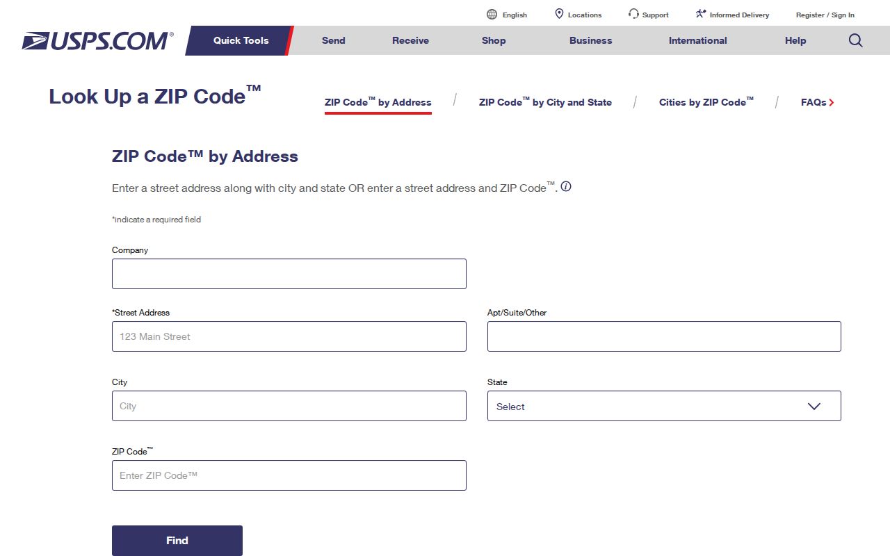
Enter a complete address in the live tool because the captured image did not include a prefilled Summerlin South result.
Search Summerlin South by ZIP Code
County systems do not all take ZIP code the same way. The Assessor’s address form uses street number, direction, name, type, and a legal City or Town selection. It does not offer a standalone ZIP field. ZIP values appear in a resulting parcel or OpenWeb map record. The Treasurer includes ZIP or Postal among its address fields, while Elections products may be organized by precinct or district instead of ZIP.
- Run the complete address through USPS and record the ZIP, ZIP+4 if returned, and the date of the result.
- Use the Clark County Assessor address search to check the situs and the legal City or Town field. Omit the city selection if it is uncertain, because that field follows the legal boundary.
- Open the matching parcel in OpenWeb and record the APN, jurisdiction, tax district, and planned land-use context with the ZIP label.
- Use the Treasurer only when a tax-statement question calls for a ZIP, situs, mailing, owner, or parcel search. Treat the result as tax data, not a resident roster.
- For election information, request the correct district or precinct product from Elections and respect its date, confidentiality, and statutory limits.
Once a ZIP code has narrowed the area, use the Summerlin South street directory for the address-by-address property and recorded-document trail.
Use Summerlin South ZIP Code Fields at Treasurer
The Clark County Treasurer tax-statement search is the county’s ZIP-capable route. It can search by parcel, individual, organization, situs address, mailing address, and an as-of date. Its street-address form includes a required street number plus city, state or province, and ZIP or Postal fields. Select a parcel first, then read the resulting tax statement as a parcel and tax identity record.
| Treasurer search field | Use in a ZIP code directory check |
|---|---|
| Situs Address | Connects the property’s physical location to a ZIP check. |
| Mailing Address | May use a different city or ZIP and should not be substituted for situs. |
| Street Number | Required on the street-address route, so copy it exactly from the address. |
| City, State or Province, ZIP or Postal | Postal filters that should be checked against USPS and the Assessor’s legal field. |
| As-of Date | Preserves the time context for a tax-statement result. |
The Treasurer parcel and address search shows the ZIP or Postal field used in this Summerlin South ZIP code workflow.
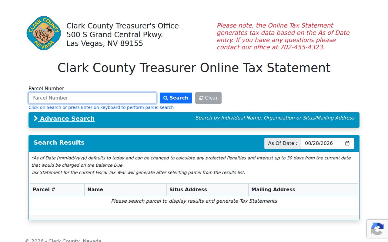
The screen is useful for parcel and address corroboration, while the Assessor and OpenWeb establish the legal jurisdiction context.
Compare Summerlin South ZIP Code Layers
The Clark County Assessor property-search hub provides parcel, owner, address, subdivision, and map routes. For a Summerlin South ZIP code directory, use it with OpenWeb rather than expecting the property form to filter ZIPs directly. OpenWeb can show parcel jurisdiction and links to the Assessor, Treasurer, Recorder, and map information. Its data is for reference and convenience, not a survey or a legal title opinion.
The Assessor search hub is the county starting point for the parcel side of a Summerlin South ZIP code confirmation.
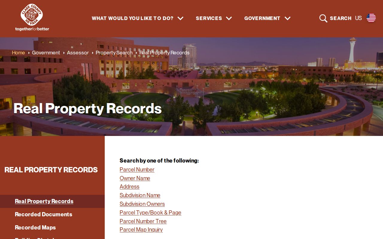
Search by the address and retain the returned parcel details so the postal result and government record can be compared later.
Keep Summerlin South ZIP Boundaries Separate
Clark County’s GIS boundaries legend includes a ZIP Code layer as well as place, township, and other boundary layers. That makes it useful for visualizing county ZIP geography, but the static research did not retain a complete live polygon query or an authoritative full table of ZIPs inside Summerlin South. The City of Las Vegas map is also context, not a certification of the town boundary. Use a selected parcel to settle an individual address question.
The Clark County GIS boundaries legend identifies the county ZIP-layer context for Summerlin South.
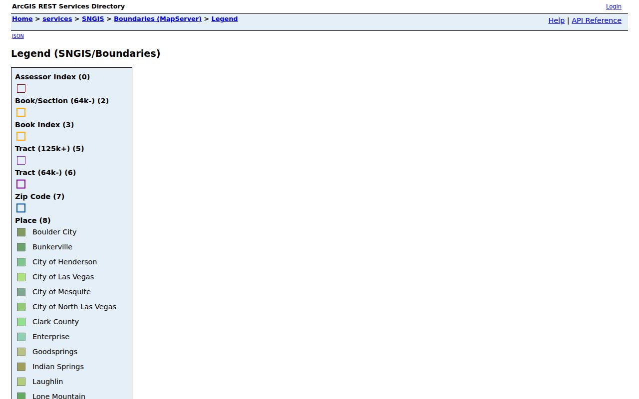
Read the ZIP layer beside the parcel jurisdiction layer so a postal area is not mistaken for the Summerlin South town boundary.
- ZIP versus ZIP+4
- A ZIP identifies a postal delivery area. ZIP+4 adds a more precise delivery segment and must be verified through USPS for the address.
- PO-box ZIP
- A postal ZIP used for post-office boxes. It does not by itself identify the property’s physical location.
- Unique ZIP
- A ZIP assigned to a single institution or organization. No Summerlin South unique ZIP was verified in the captured sources.
- Carrier route
- A delivery-route grouping used by postal operations. It is not a city, town, parcel, or court jurisdiction.
Boundary caution. A ZIP code is a mail-routing tool, not a municipality, CDP, HOA, court venue, tax district, or proof that a person lives at an address.
Read Summerlin South ZIP Geography by Scope
Summerlin South has more than one geographic footprint in official materials. The current county page describes an unincorporated town with 6,129 acres and 10 square miles. An older county land-use page gives approximately 7,099 acres. The broader master plan describes nearly 12.5 square miles and about 8,000 acres. These figures are not competing ZIP totals. They describe different sources, dates, and planning scopes.
The key local fact is that the Summerlin name crosses the City of Las Vegas and unincorporated Clark County line. Charleston Boulevard is identified on the Summerlin HOA map as the dividing line, while county material identifies Summerlin South as an unincorporated town. Record the postal label, parcel jurisdiction, and source date together when documenting a boundary conflict.
Development timing adds another limit. The Summerlin South Land Use and Development Guide was approved in 1995, followed by a Development Agreement in 1996 and later updates in 2005. Many streets and subdivisions therefore postdate older Las Vegas maps and directory runs. An older address source may help normalize a road name, but it cannot supply a modern ZIP code or replace a current USPS and parcel check.
Note: Nearby Summerlin ZIP labels need USPS and parcel confirmation before they are described as part of Summerlin South.